
Plan a bike route with its height profile
From Zurich main station to the Uetliberg as the example: 10 km and about 500 m of climb.
- Tap the blue arrow beside the search box. Directions open with your location as the start.
- Type the destination, such as “Uetliberg”, and pick it from the list. You can also open a place and tap Directions, or right-click the map (long press on a phone) and choose Directions to here.
- To start somewhere else, tap the start and type another place.
- Choose Bike. The route appears with its time, distance and the height profile.
- Add up to 8 stops for places you want to pass on the way.
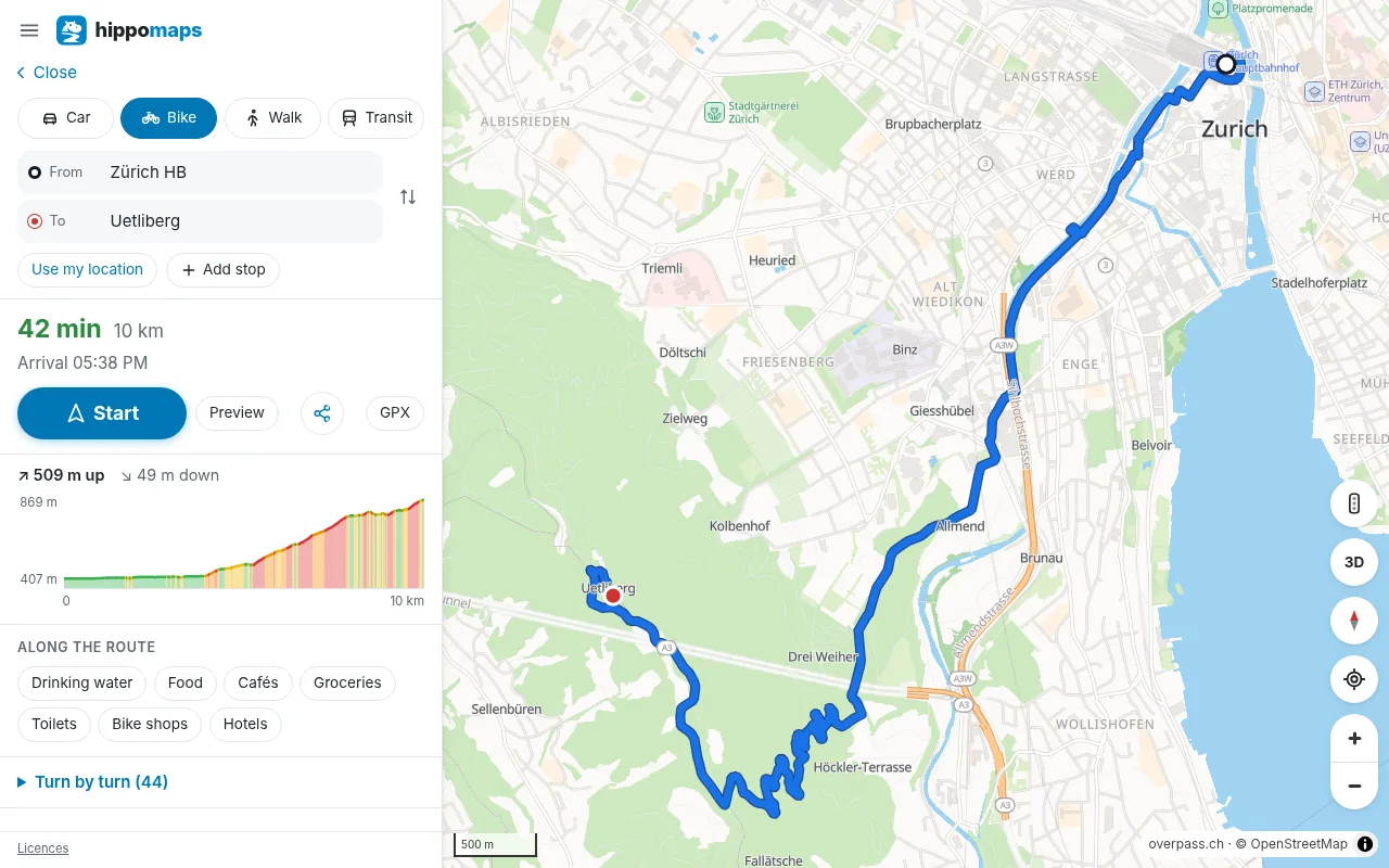
Read the height profile
The profile shows the heights along the route, with the total climb and descent. Move the mouse or a finger along it: a dot on the map shows where that point is. Use it to find the steep parts before you ride them.
Other routes
When there are other good routes, they appear paler on the map with how much longer they take. Tap one to see its profile.
Water, food and bike shops on the way
Under the route, Along the route lists drinking water, food, cafés, bike shops and more near the route, with how far each is.
GPX, navigation and sharing
- Tap GPX to save the route as a track with its heights, for a bike computer or a watch (more on GPX).
- Tap Start for spoken navigation. The map along the route is saved on the phone at Start.
- Share the route as a link (how).