
Measure and GPS files
Measure the length of a walk or the area of a field, with the heights along the line. Lines, routes and search results can be saved for a GPS device.
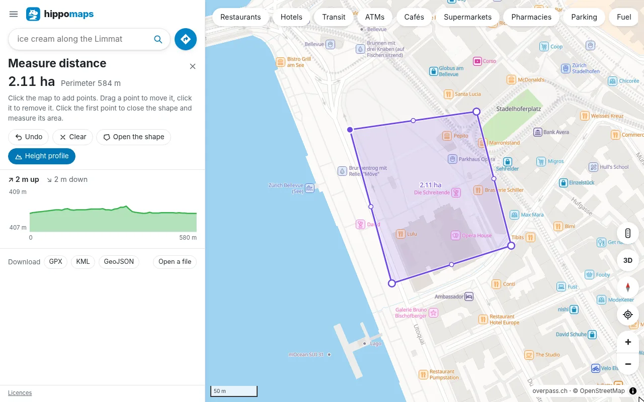
Measure distance
Open Measure distance from the menu, or right-click the map (long press on a phone) and choose it there. Then:
- each click on the map adds a point and shows the length of the line
- a click on the first point closes the shape and gives its area and perimeter
- drag a point to move it, click it to remove it, or drag the dot in the middle of a part to add one
- Undo, Ctrl+Z or Backspace go back a step
Lengths and areas are calculated on the sphere of the Earth, so they hold for long lines too.
Height profile
Height profile shows the heights along the line with the climb and the descent. Move along it to see each point on the map. The heights come from a 2 m grid in Switzerland and a 30 m grid elsewhere.
Reachable area
Reachable area shows how far you get from a point by car or public transport (up to an hour), by bike or on foot (up to two hours). Each step of time has its own colour, from green near the start to red, and its area. Open it from the menu, where it starts at your location, or right-click the map and choose Reachable from here. Click the map or drag the pin to move the start. By car it counts the traffic of the moment where hippomaps has traffic data. By public transport it leaves now by the timetables, with the walk to the first stop timed to a departure, and walks on from each stop reached.
Files
A measured line can be saved as GPX (with its heights), KML for Google Earth, or GeoJSON for a GIS. The same goes for other things in hippomaps:
- a route, as a GPX track with its heights by bike and on foot
- the results of a search, as GPX waypoints, CSV or GeoJSON
- a reachable area, as GeoJSON with its colours (geojson.io and QGIS show them) or KML
Open a GPX, KML or GeoJSON file in Measure, or drop it on the map, to see its track with its length and heights. The guide Put a route on a GPS device goes through it step by step.
Files are saved and opened in the browser. On Android, use hippomaps.ch in the browser for them.